St Mary's Falls
St Mary's Falls is a classic Colorado Hike. Climbing for 3 miles, it takes you through a forested valley to the base of a Steep Ravine where the water cascades down from higher up the valley. Like most of the falls in this area, this one can be counted on to be running year round. Spring time has best conditions for viewing. Hike is moderate, making it a good family hike and running water makes it great for the dogs. Most of the trail is shaded enough to make it a good hike in warmer conditions.
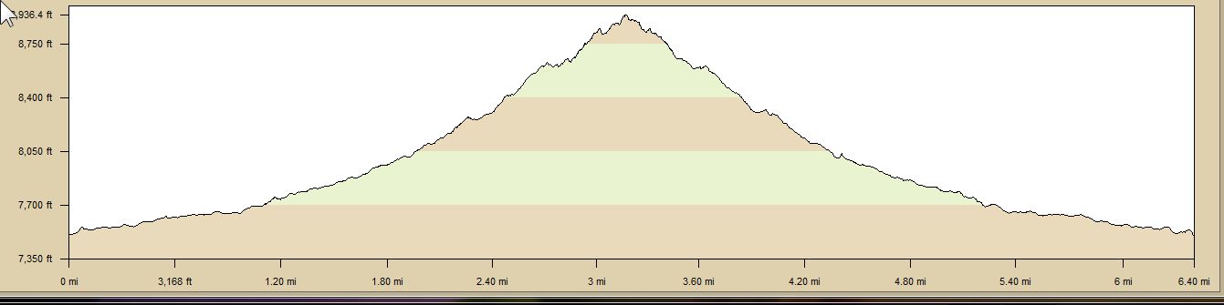
| TrailHead Coordinates N38.791143 W104.904589 | Start Elevation 7500 ft | Highest Elevation 8950 ft | Lowest Elevation 7500 ft | Elevation Gain/Chg 1550/3100 ft | Current Weather |
Trailhead / Access
Access to St Mary's Falls is best via the trailhead / parking lot at the intersection of Gold Camp Road, High Drive, and Cheyenne Canyon. this is about 1/2 mile above St Helens Falls. The easiest road access is via Cheyenne Canyon. Gold Camp and High Drives are not paved and narrow in places.
Trail Description
The trail takes off from the southwest corner of the parking area. There is a gate to keep vehicular traffic off the road that marks the start. The first 1.2 miles of the trail follows Gold Camp Road.
Just after climbing over the closed railroad tunnel, the signage will direct you to the right and on to a single track trail that climbs to the Southwest. The trail will climb gently for about a mile with only a couple of steeper sections. A stream will be on your left. Dogs love to hit all watery spots for a cool off.
The last section of the trail will be on steeper trail but nothing too bad. At the sign indicating .2 miles, the trail moves away from the stream to gain some altitude before swinging back to the base of the falls. The .2 miles was about .33 according to GPS and the sign for 500 ft was about 700 ft.